The 2.5 mile Lakeside Trail circles Choctaw Lake in close proximity to its shore. Approximately 1.2 mile of the trail along the eastern shore of the lake (map) allows views of lakeshore vegetation as well as flowering plants in both mature pine and pine hardwood understories in spring and summer. Wooden footbridges traverse the upper end of the Lake allowing close-up views of aquatic plants ranging from alders and buttonbush to lizard tails, rushes and water-lilies as well as turtles, frogs, snakes and songbirds. The visitor may leave Lakeside Trail near the comfort station in the northwest corner of Choctaw Lake (map) and enter Chata Trail. It is approximately 1.5 miles in length ascending, descending and running atop low ridges through upland pine and hardwood forests and connecting with the Cabin Lake Trail around Cabin Lake. Noxubee Hills/Beaver lodge Trail (1.6 miles) runs south and east from Choctaw Lake levee/parking area (map) through forests of pine, bottomland hardwoods and mixed pine hardwoods. Most of this trail is fairly flat and pleasant walking with the last 0.1 mile ascending a small ridge affording a view of the Noxubee River. A few small creeks are crossed and the trail borders a large beaver pond near its end affording views of diversified wetland vegetation and wildlife. This last trail was designed for mountain bikes so be aware of their possible presence.
Choctaw Lake Recreation Area Trail is not affiliated with AmericanTowns Media
As an “anything goes” type of dish, soup has a way to sate almost any appetite. Mississippi restaurants have taken care to craft delicious homemade soups that will make you think twice… Read More
Mississippi — the birthplace of teddy bears, the Blues, and soul food — should be at the top of your travel list. From flats in Clarksdale to mansions in Pass Christian, read on to… Read More
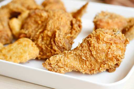
If there's any state in the U.S. where you expect to find incredible fried chicken, it has to be Mississippi. Naturally, we strongly agree about the best place to get fried chicken around here! We've… Read More
Whether you live in Mississippi or are a tourist, there are plenty of things to do when it’s raining. From the U.S.S. Cairo Museum in Vicksburg to the Horseshoe Casino in Tunica, chase away… Read More
Coca-Cola, cheeseburgers and fries, comfort foods—these classic American icons were made popular with the help of mom and pop diners. Having been around for decades, the diner still hasn’t gone out… Read More